This paddle was originally open to everyone but as there was
hardly any interest shown (is anyone out there?) We decided
to use the day to paddle around the Isle of Portland from
Sandsfoot to Chesil Cove – that is East to West.
After careful planning using the tidal flow charts and
monitoring the weather over the previous few days, five
members of IOPCC met at Sandsfoot and decided to head off
towards the Bill.
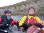
The five paddlers – Jon, Dicky, Toby, Ian and I are all
experienced and also used to paddling with each other. We
were suitable dressed for the chilly conditions and had all
the necessary safety equipment with us in quantity.
Expectations of staying close together and looking out for
each other were implicit.
It was evident from the sea state in Portland Harbour that
this wasn’t going to be a quiet little dibble. The wind was
Force 3 – 4 mainly E/ENE but it was sufficient to produce
waves in the harbour. We had spoken to Portland Coastguard
to log our trip before leaving Sandsfoot beach at 10.30 and
as we crossed towards the South Ship Channel we heard a
group of 16 paddlers also logging their trip. They were from
Upper Hamble Canoe Club and were paddling from Castletown to
Chesil Cove. Our initial thoughts were that this was a very
large group to be tackling such a serious stretch of water.
As we approached the South Ship Channel we could see that
the sea was rough. There was significant tidal flow in the
entrance which is normal but the sea outside was also quite
rough with some breaking waves. This produced much whooping
and hollering from Dicky and Jon as they enjoyed bouncing
their way out!
As we made our way along the East coast of the Isle we were
surprised by the speed and strength of the tidal flow. This
was a small tide we were paddling on and although tidal flow
on the flood is strong, it was more than we had expected. It
was all going our way, though, so we made good progress. Off
every little point there was tidal activity, known as
‘shaffles’ locally. The race off Grove Point was extensive.
As we approached Red Crane (?) the promontory just before
the Bill the sea looked significantly rougher ahead and I
put my camera away (Bad sign!). We had a reality check
whilst being swiftly taken into the rough water by the tide.
Staying close together we negotiated this section of rough
water and rounded the corner to find relative calm at the
Bill of Portland. We took time to wave and pose for
photographs by our shore party, Sharon and Keith, before
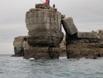
moving on towards Pulpit Rock. Jon just could not resist
paddling through Pulpit Rock despite a huddle of fishermen
on it with lines out in all directions. We were at this
point at 12.15 - an hour and a half after leaving Sandsfoot.
The sea was much calmer on the west side of the Isle with
the entire race on the flood being off to the East. There
was however a large groundswell with some huge lumps of
water coming through.
We paddled down the West Coast of Portland stopping to eat
Toby’s cheese and pickled onion sandwiches. When we were off
Blacknor Point, Portland Coastguard called us on VHF to warn
us of large dumping surf at Chesil Cove which might make our
landing difficult. Nobby had called in with the information
and asked it to be passed on. Thanks Nobby for giving us the
heads up on this.
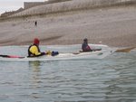
We paddled down to Chesil as a group and decided we would
land because as it was now 13.15 it was too late to consider
paddling back round the Island. We observed the landing for
a while and Dicky chose his spot and got ashore perfectly.
Once one person is safely ashore it is easier for the rest
of the group and we all landed without incident.
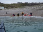
We were quite cold once ashore but all had hot drinks and
food with us and were soon warmed up with the exercise of
carrying the boats up Chesil Beach. Sharon had kindly
offered to be our taxi service as well as photographer and
shore contact so we soon had the shuttle underway.
A friend of the other group of kayakers was at Chesil
Cove waiting for them to appear. It turned out that they
were from The Upper Hamble Canoe Club. She told us that they
were an experienced group and had coaches with them and had
done much bigger trips than this. I turned my VHF back on at
this point – about 15.00.
When we left Chesil Cove there was no sign of the Hamble
group and, of course, we now know why. They were about to be
involved in one of the biggest incidents involving kayakers
for some time. They sent their mayday at 16.00 and at this
point they were off the Bill. You can read more about their
incident by following the links on this page.
The first we knew about the incident was when I had a call
from Ken at about 17.15 – asking if it was us! Thankfully it
wasn’t.
I don’t know what went wrong on the water but I do know that
the conditions were much worse than we had expected from the
weather forecast and the size of the tide. The Hamble group
were out for a very long time, their original intention was
to come into Chesil Cove but it looks as if they may have
come round the Bill and then decided to try to paddle back
to Portland Harbour. It all went horribly wrong for them but
thankfully all 16 were saved by the RNLI in a very
impressive rescue co-ordinated by Portland Coastguard.
This incident must make us very determined to make sure it
doesn’t happen to us. Planning is very important especially
in an area like the Isle of Portland. Everyone knows
Portland Bill is potentially a dangerous place to be. They
know all this – this is a quote from The Upper Hamble Canoe
Club website…
“However, the ocean can be temperamental, so weather,
tides and charts should be considered and journeys planned.”
Mistakes were made and I suspect their biggest errors were
made before they got on the water. In my first few months of
sea paddling I received some sound and memorable advice from
Mark Rainsley. Something along the lines of ‘the most
important skill you will develop as a sea kayaker is when to
go and when not to go’. Wise words. |
 |
 |
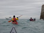
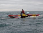
| Portland Harbour at
the Hood Entrance |
Bit choppy on the way
to Grove Point |
| |
|
 |
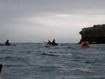 |
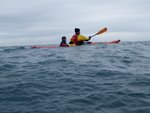
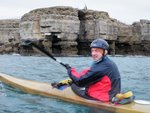
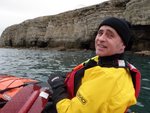
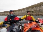
| Toby and Ian |
Approaching the Bill |
| |
|
 |
 |
| Pulpit Rock |
Jon |
| |
|
 |
 |
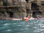
| Time to check out the
caves |
Dicky |
| |
|
 |
 |
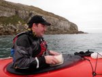
| Toby and his world
class cheese and pickled onion sandwiches |
Jon and Dicky |
| |
|
 |
 |
| Pig! |
Waiting to land at
Chesil Cove |
| |
|
 |
 |
| Safe and sound |
Shore contact,
photographer, taxi service and superstar...Sharon |
| |
|
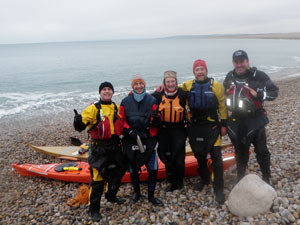 |
| Team IOPCC |
| |
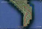 |
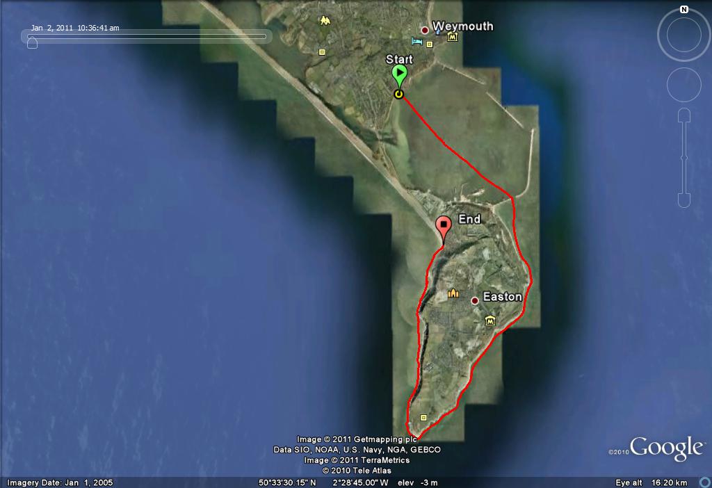
GPS trace of the paddle.
Click the thumbnail to view a bigger image. |
|