| Paddlers |
|
| Tony Sandry |
Mark Whitaker |
| Michele Springall |
|
With so many trips cancelled this year
because of high winds, it was a relief to see the
weather forecasts for the weekend. Light winds and lots
of warm sunshine would be a welcome change from blustery
showers.
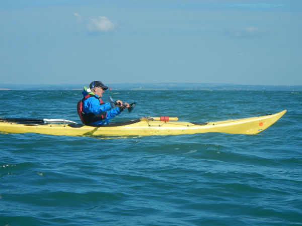
Mark Whitaker (PDCC)
The outward journey from Seaford Head
was uneventful, and the sea was slight, with a light
offshore wind. Apart from the few headlands, tidal
streams along this coast are not very strong and we were
between Spring and Neap tides.
Alan MacKenzie, a professional
photographer has some great images on his Flickr
photostream.
This link is the much photographed view
of the Seven Sisters from Hope Cove/Cuckmere Haven.
After Beachy Head we stopped for a
coffee at the Holywell café. This is the western
terminus for the Dotto train which slowly meanders along
the Eastbourne seafront during the summer. It was a long
time since I visited this café, and it had clearly had a
major refurbishment. Latte and exotic teas were now the
order of the day instead of instant coffee and tea of
the stewed variety.
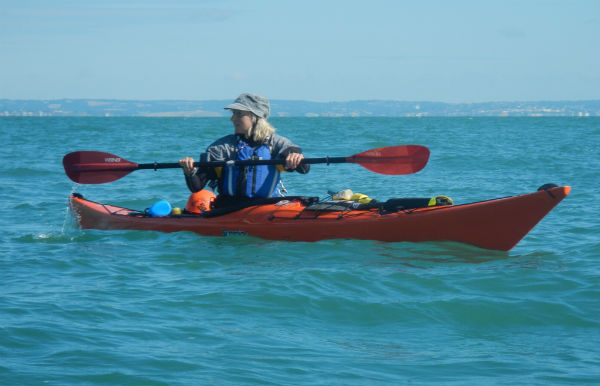
Michele Springall
We paddled close to the beach and under
the fire damaged pier. Langley Point and its huge
development seemed to go on forever. The harbour and
adjacent multi-story buildings, like much of Eastbourne,
are built on a flood plain, and many houses are below
sea level. Some of the seafront properties looked
perilously vulnerable to the sea if some of our global
warning predictions are ever realised.
Wild camping on Pevensey Beach is more
urban camping, as it’s impossible to get more than a
hundred yards away from houses.
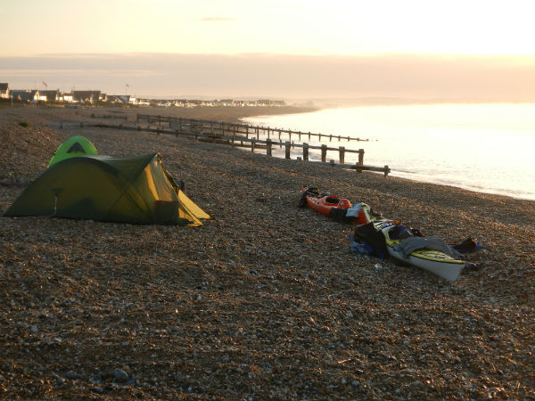
Campsite at
Pevensey Beach
There is an
Environmental Agency compound, with a small wind
generator not far from the public car park. We camped
near this compound and only saw a few people whilst we
pitched our tents.
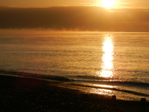
Early morning over
Pevensey Bay
To catch the tides we had to leave about
08.30. The
Royal Sovereign Light looked very small.
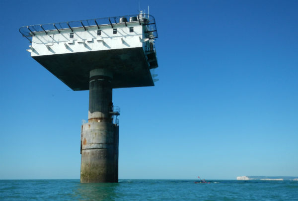
Royal Sovereign
Light
We
had a slight sea and light tailwind to aid (or hinder)
us. The paddle took about two hours and we spent about
twenty minutes having a bite to eat and taking a few
photographs, before heading off to Beachy Head.
There had been a Light Ship on the Royal
Sovereign Shoal since 1875. It was replaced in 1971 by
the present light. It is one of the least attractive
lighthouses in the UK, but has served it's purpose
adequately enough.
Lunch break at the
Royal Sovereign Light.
The return journey took us about two and
a half hours, and for the last hour we had a stiff
headwind and some lumpy conditions to contend with. As
we closed onto the coast it was obvious that we were
losing ground to the tide so we had to adjust our
course. We stayed close to the beach and made our way to
the lighthouse.
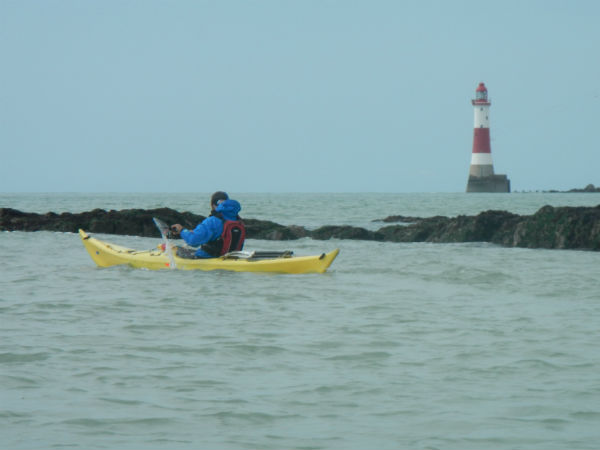
Mark approaching
Beachy Head Lighthouse at low water. The reef in the
foreground can produce some challenging conditions in
rough conditions.
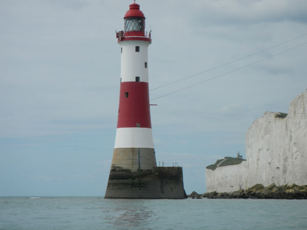
Beachy Head
Lighthouse with Belle Toute (The original lighthouse) in
the background.
This link is of Beachy Head Lighthouse
at a very low Spring tide. The view is looking west
towards Birling gap and Seaford Head.
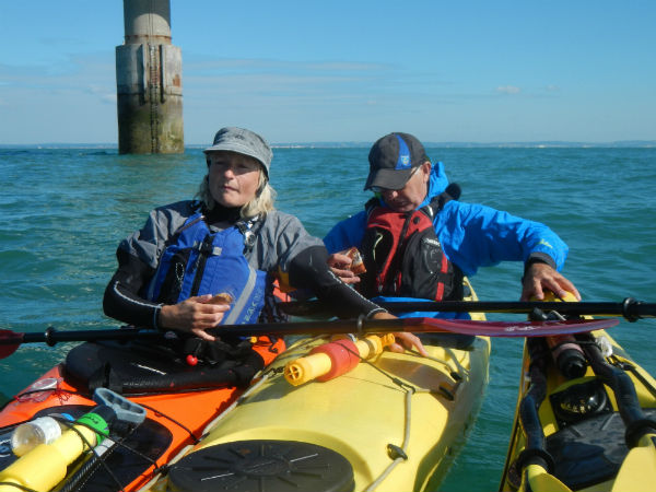
A couple of kayakers out for a short
paddle from Eastbourne caught up with us. Michelle knew
them and we had a brief chat before pressing on to
Birling Gap for a much needed break. We had been in our
boats for five and a half hours and needed to stretch
our legs.
The chalk cliffs of the Seven Sisters
are world famous. Although the sea erodes the chalk face
from below, the near vertical faces of the cliffs are
mainly caused by heavy rain passing through the chalk
and then freezing. The expanding water cracks the chalk,
causing the cliffs to erode from the top.
At Birling Gap the geology is different
to the Seven Sisters and it consists mainly of coombe
rock. The dry valley was created during the last ice
age. The coombe rock is much softer than the chalk and
so it erodes at a faster rate, causing a bay at Birling
Gap.
Because the cliff at Birling Gap
collapses on a regular basis, the tower staircase is
designed to cope with these falls. The National Trust
car park and café were busy, although the expensive
coffee machine wasn’t playing ball, so the multitude of
visitors had to make do with tea or filter coffee. The
National Trust has an ‘Interpretation Centre’ with
photographs that show the extent of the cliff collapses
over the last century.
This link from a Sussex archaeological
website shows the extent of the cliffs retreat.
After a decent break lounging around on
the beach, we set off on the final leg of the paddle to
Seaford Head. We had a great view of the Seven Sisters
with Cuckmere Haven and Hope Cove beyond.
This link is the view looking west from Birling Gap.
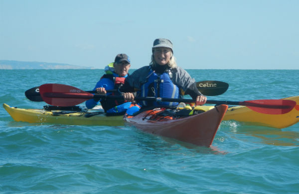
Mark and Michele
The wind had got up a little and was
blowing into our faces, so we had no following sea to
surf our way back to the beach.
Michelle and Mark did a slick exit onto the steeply
shelving beach at Seaford Head. (I wish I could do
that). Less gracefully, I then paddled furiously onto
the beach and with their help I managed to get out of
the boat before it slid back into the sea.